


Page 106 - Demo
P. 106
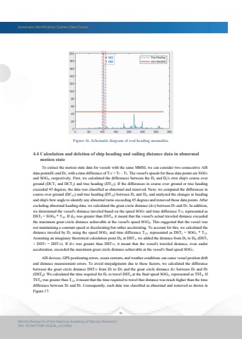
Automatic Identification System Data Fusion94Marine Research of the National Academy of Marine ResearchDOI: 10.29677/MR.202406_4(1).0006Figure 16. Schematic diagram of real heading anomalies. AIS devices, GPS positioning errors, ocean currents, and weather conditions can cause vessel position drift and distance measurement errors. To avoid misjudgments due to these factors, we calculated the difference between the great circle distance DST12 from D2 to DX and the great circle distance d12 between D1 and D2(DSTd). We calculated the time required for D1 to travel DSTd at the final speed SOG1, represented as TSTd. If TSTd was greater than T12, it meant that the time required to travel that distance was much higher than the time difference between D1 and D2. Consequently, such data was classified as abnormal and removed as shown in Figure 17. To extract the motion state data for vessels with the same MMSI, we can consider two consecutive AIS data pointsD1 and D2, with a time difference of T12 = T1 %u2013 T2. The vessel's speeds for these data points are SOG1and SOG2, respectively. First, we calculated the differences between the D1 and D2's own ship's course over ground (DCT1 and DCT2) and true heading (DT12). If the differences in course over ground or true heading exceeded 45 degrees, the data was classified as abnormal and removed. Next, we computed the differences in course over ground (DC12) and true heading (DT12) between D1 and D2, and analyzed the changes in heading and ship's bow angle to identify any abnormal turns exceeding 45 degrees and removed those data points. After excluding abnormal heading data, we calculated the great circle distance (d12) between D1 and D2. In addition, we determined the vessel's distance traveled based on the speed SOG2 and time difference T12, represented as DST2 = SOG2 * T12. If d12 was greater than DST2, it meant that the vessel's actual traveled distance exceeded the maximum great circle distance achievable at the vessel's speed SOG2. This suggested that the vessel wasnot maintaining a constant speed or decelerating but rather accelerating. To account for this, we calculated the distance traveled by D1 using the speed SOG1 and time difference T12, represented as DST1 = SOG1 * T12. Assuming an imaginary theoretical calculation point DX at DST1, we added the distance from D2 to DX (DST1+ DST2 = DST12). If d12 was greater than DST12, it meant that the vessel's traveled distance, even underacceleration, exceeded the maximum great circle distance achievable at the vessel's final speed SOG1.4.4 Calculation and deletion of ship heading and sailing distance data in abnormal motion state


