


Page 107 - Demo
P. 107
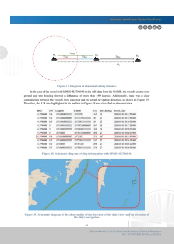
Automatic Identification System Data Fusion95Marine Research of the National Academy of Marine ResearchDOI: 10.29677/MR.202406_4(1).0006 In the case of the vessel with MMSI 413706040 in the AIS data from the NAMR, the vessel's course over ground and true heading showed a difference of more than 140 degrees. Additionally, there was a clearcontradiction between the vessel's bow direction and its actual navigation direction, as shown in Figure 19. Therefore, the AIS data highlighted in the red box in Figure 18 was classified as abnormal data.Figure 17. Diagram of abnormal sailing distance.Figure 19. Schematic diagram of the abnormality of the direction of the ship's bow and the direction ofthe ship's navigation.Figure 18. Schematic diagram of ship information with MMSI 413706040.


