


Page 79 - Demo
P. 79
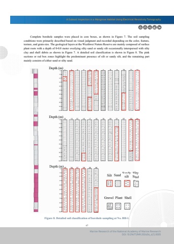
A Subsoil Inspection in a Mangrove Habitat Using Electrical Resistivity Tomography67Marine Research of the National Academy of Marine ResearchDOI: 10.29677/MR.202406_4(1).0005Figure 8. Detailed soil classification of borehole sampling at No. BH-1. Complete borehole samples were placed in core boxes, as shown in Figure 7. The soil sampling conditions were primarily described based on visual judgment and recorded depending on the color, feature,texture, and grain size. The geological layers at the Wazihwei Nature Reserve are mainly composed of surfaceplant roots with a depth of 0-0.8 meter overlying silty sand or sandy silt occasionally interspersed with siltyclay and shell debris as shown in Figure 7. A detailed soil classification is shown in Figure 8. The pink sections or red box zones highlight the predominant presence of silt or sandy silt, and the remaining part mainly consists of either sand or silty sand.


