


Page 94 - Demo
P. 94
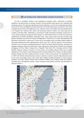
Automatic Identification System Data Fusion82Marine Research of the National Academy of Marine ResearchDOI: 10.29677/MR.202406_4(1).00062 AUTOMATIC IDENTIFICATION SYSTEM In order to strengthen maritime vessel management, navigation safety, enforcement of maritimeregulations, and rapid response to maritime incidents, relevant maritime safety agencies have established ship monitoring systems. The Automatic Identification System (AIS) plays a crucial role in monitoring the dynamic movements of vessels, enabling the tracking of distressed vessels and improving rescue efficiency. This system exchanges electronic data with neighboring vessels, AIS shore stations, and satellites, allowing AIS information to be integrated into maritime radar systems. By prioritizing collision avoidance, the system helps prevent accidents in maritime traffic. Additionally, it can broadcast weather information and danger warning zones to vessels, thereby enhancing navigational safety. Huang et al., (2019) discussed the use of AIS receiving stations established by the Harbor and Marine Technology Center. These stations collect AIS data and utilize ship dynamic information as the basis for analysis and applications. This allows for a clearer understanding of the fluctuation of ship traffic in major ports in Taiwan and its surrounding waters, providing valuable insights for ship channel planning and policy implementation. By the end of 2017, AIS base stations in Taiwan had been installed in various locations, including Keelung Port, Taipei Port, Miaoli Waipu Fishing Port, Taichung Port, Changhua Wangong Fishing Port, Budai Port, Tainan Anping Port, Kaohsiung Port, Hualien Port, Pingtung (Donggang, Cat Nose, Xuhai), Taitung (Fu'ao, Changbin), Yilan (Su'ao Port, Toucheng), and New Taipei (Ruifang, Shimen), totaling 18 locations in Taiwan proper, and including outlying islands such as Penghu (Magong Port, Jibei Island), Orchid Island Kaiyuan Port, Kinmen (Shuitou Port, Wuqiu), and Matsu (Beigan, Dongyin, Dongju, Fuao Port), totaling 9 locations. In total, 27 AIS receiving stations were established (Liu et al., 2019). The AIS data collected from these stations is utilized to construct a real-time ship information system for the waters surrounding Taiwan. This system offers publicly available information on ship navigation, including vessel types, Maritime Mobile Service Identities (MMSI), speed, heading, latitude and longitude, destination ports, and departure locations, which encompasses both dynamic and static ship information, as depicted in Figure 2.Figure 2. The real-time ship information system. (Marine Traffic, 2024)


