


Page 93 - Demo
P. 93
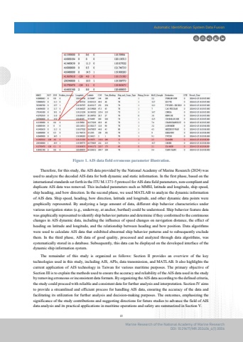
Automatic Identification System Data Fusion81Marine Research of the National Academy of Marine ResearchDOI: 10.29677/MR.202406_4(1).0006 The remainder of this study is organized as follows: Section II provides an overview of the keytechnologies used in this study, including AIS, APIs, data transmission, and MATLAB. It also highlights the current application of AIS technology in Taiwan for various maritime purposes. The primary objective of Section III is to explain the methods used to ensure the accuracy and reliability of the AIS data used in the study by removing erroneous or inconsistent data formats. By organizing the AIS data according to the defined criteria,the study could proceed with reliable and consistent data for further analysis and interpretation. Section IV aims to provide a streamlined and efficient process for handling AIS data, ensuring the accuracy of the data and facilitating its utilization for further analysis and decision-making purposes. The outcomes, emphasizing the significance of the study contributions and suggesting directions for future studies to advance the field of AIS data analysis and its practical applications in maritime operations and safety are summarized in Section V. Therefore, for this study, the AIS data provided by the National Academy of Marine Research (2024) was used to analyze the decoded AIS data for both dynamic and static information. In the first phase, based on the international standards set forth in the ITU M.1371-5 protocol for AIS data field parameters, non-compliant and duplicate AIS data was removed. This included parameters such as MMSI, latitude and longitude, ship speed, ship heading, and bow direction. In the second phase, we used MATLAB to analyze the dynamic information of AIS data. Ship speed, heading, bow direction, latitude and longitude, and other dynamic data points were graphically represented. By analyzing a large amount of data, different ship behavior characteristics under various navigation states (e.g., underway, at anchor, berthed) could be understood. Ship behavior feature data was graphically represented to identify ship behavior patterns and determine if they conformed to the continuouschanges in AIS dynamic data, including the influence of speed changes on navigation distance, the effect of heading on latitude and longitude, and the relationship between heading and bow position. Data algorithms were used to calculate AIS data that exhibited abnormal ship behavior patterns and to subsequently exclude them. In the third phase, AIS data of good quality, processed and analyzed through data algorithms, wassystematically stored in a database. Subsequently, this data can be displayed on the developed interface of the dynamic ship information system.Figure 1. AIS data field erroneous parameter illustration.


