.Establish a national marine observation network
.Establish a national marine database and big data application
.Conduct long-term and basic marine science research
In order to enable the public to fully understand the sea conditions on the surface and underwater before engaging in recreational and fishing activities, the NAMR set up anchor buoy stations in four demonstration coastal areas in 2021 and presented live measurements of marine phenomena and hydrological and water quality data through a website to provide the public with safe, healthy, and convenient sea-friendly conditions.
In order to promote the public to "know the sea, engage with the sea, and enter the sea" (知海, 近海, 進海), we have taken in the needs and opinions of the participants, tourists, industry players, experts and scholars engaged in marine recreation activities, and profoundly identify that only by creating a friendly and safe marine environment can we promote more people to "know the sea" and "engage with the sea" and gradually achieve the goal of "entering the sea".
The parameters of the marine environment that people are more concerned about when engaging in marine recreation activities include wind (speed and direction), sunlight intensity, rainfall rate, wave height, tides, currents (surface and underwater 3D), temperature, water temperature (surface and underwater 3D), turbidity (underwater visibility), water depth and topography and substrate conditions (sand, gravel, reefs or coral reefs, etc.). In order to improve the overall safety and quality of recreational activities in the sea, the National Academy of Marine Research (NAMR) set up multi-parameter anchor buoy systems in 4 demonstration sites in 2021, including the northern, northeastern and southern parts of the main island of Taiwan and the outlying island of Penghu. The multi-parameter anchor buoy system provides information on wind, waves, currents, air temperature, surface and underwater temperature, salinity, turbidity, chlorophyll fluorescence and other maritime, hydrological, and water quality information related to recreation safety and recreation quality. The information is updated hourly on the website so that the public can keep abreast of the latest developments in the marine environment and obtain relevant environmental information before going to the destination area to assess the appropriate type of marine activities and itinerary in advance..png)
Suspended Particle Concentration
For the purpose of nearshore (littoral zone) recreation safety and simulation, the NAMR conducted a series of nearshore topographic surveys for the north coast and northeast coast, the seas around the Penghu islands and Hengchun Peninsula, hoping to have a better resolution on the boundary information for sea current simulation and to grasp the characteristics of the sea bed topography at the same time.
Topographic survey of the northern coastal areas: the distribution of artificial reefs on the north coast was found, which can be used as a reference for recreational divers and fishermen.
Topographic survey of northeastern coastal area
Topographic survey of Penghu’s coastal areas: utilizing multibeam echosounder and side-scan sonar to observe the characteristics of the seabed in the southern part of Penghu and using airborne radar to observe coastal changes
Topographic survey of Hengchun’s coastal areas: many reefs or pits were observed on the seabed of Hengchun’s marine areas and coastal changes were observed by airborne radar.
Extended research: Integration of topographic and substrate technologies for outlying islands: the distribution of artificial structures on the seabed can be used as a reference for people to conduct nearshore recreation or dive planning; integration of shipborne and towed multibeam echosounder and satellite inversion for topographic surveys in outlying islands; combination of seabed scattering intensity and substrate profile sampling verification for substrate surveys
Small anchor data buoys are small and compact. In addition to the payload capacity of the scientific instruments comparable to large buoys, the cost, deployment and maintenance operations require a lower technical threshold and cost than large buoys and has the advantage of working in shallow waters, suitable for meteorological and underwater observation tasks along the nearshore areas.
The advantages of the small anchor data buoy include reduced difficulty and cost of transportation, deployment, maintenance, etc. and the ability to maintain the payload of multiple measurement instruments; due to its small size, it has less impact on the public engaging in coastal activities, and is suitable for sea areas with frequent human activities such as recreational areas, fishing areas and even near shore, ports or lakes.
The 1m anchor data buoy system has a diameter of about 97cm and a height of about 56cm, and can provide buoyancy of about 290kg (including stainless steel instrument stand), and can be divided into three parts: upper frame, center and lower frame. The measuring instrument can be installed on the buoy or on the anchor at the appropriate position according to the requirements. The upper frame provides a good view and solar panels, communication and navigation safety related equipment (such as solar warning lights and radar reflectors) are installed, while 3 sets of solar panels are fixed and connected to 3 sets of 28Ah batteries in the inner well of the buoy. The center of the marker is close to the sea surface, because the amplitude of wave sway is smaller, the buoy inner well is suitable for placing control system and power supply components; the control system function includes the data storage of the payload instrument and the remote control of the system, the recorded environmental data is transmitted to the cloud data platform through Iridium satellite or 4G communications. The lower frame is installed with current profiler and the anchor is connected in series to control the buoy to drift in a certain range.
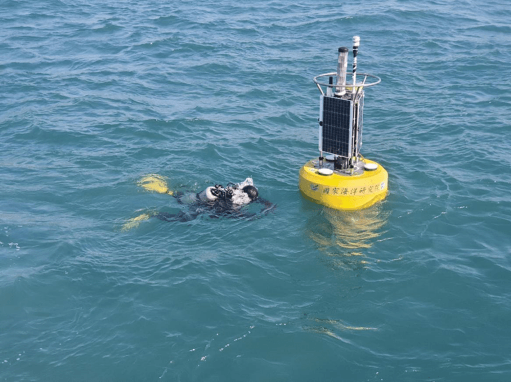
Diving at the buoy anchor position for routine system inspections
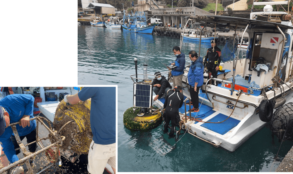
Detaching the buoy from the anchor and conducting maintenance operations on board or transport it back to the harbor.
